Trails | Scotland | East Highland Way
EAST HIGHLAND WAY
It certainly should be – might even be one of the better trails you’ve never heard of!
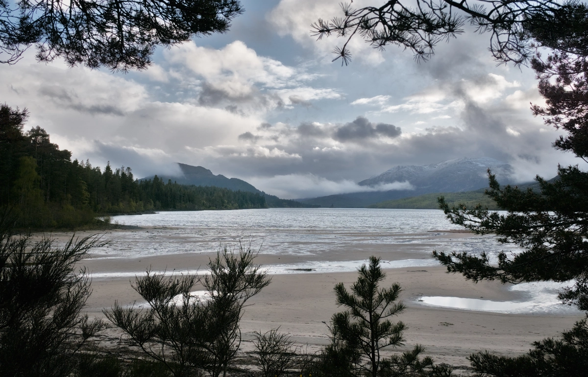
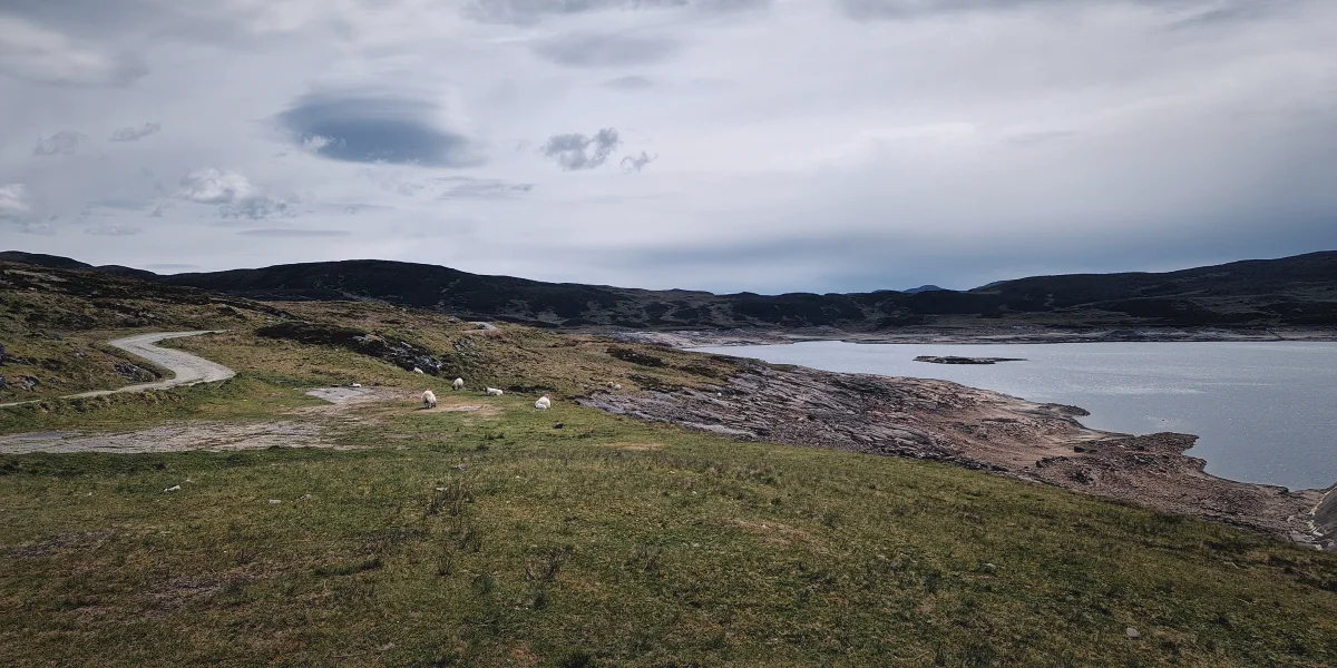
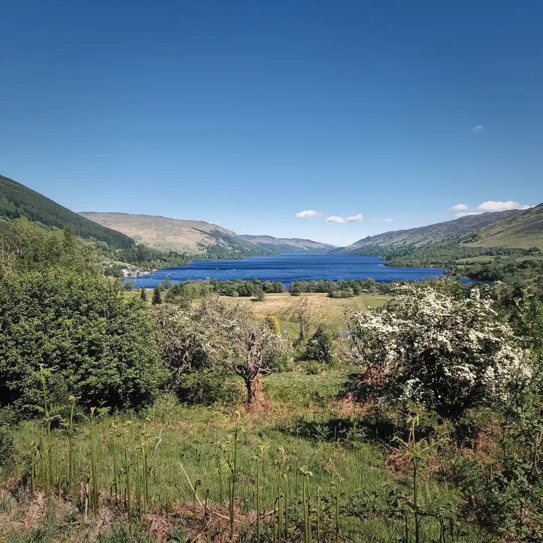
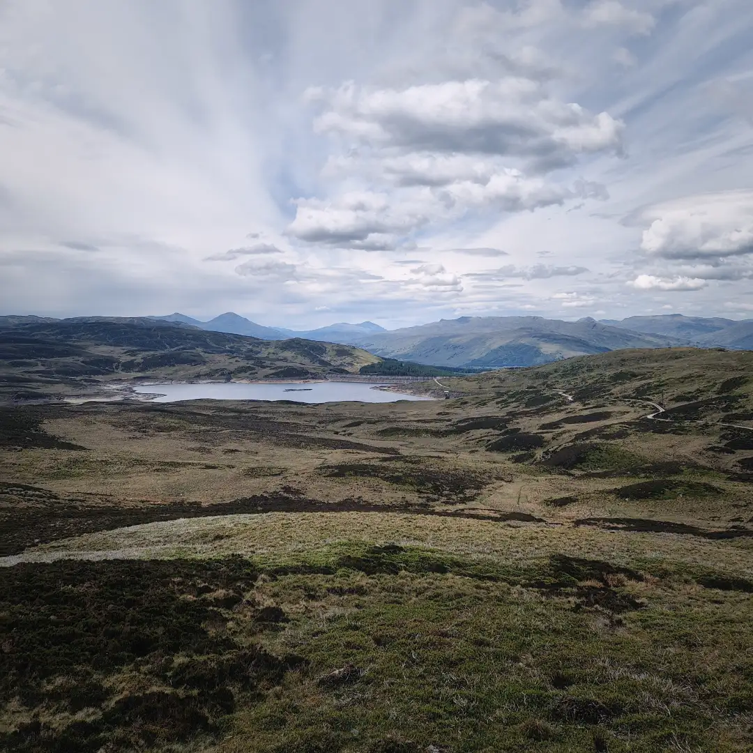
A south-easterly view of the Shee of Ardtalnaig, a steep ridge dividing two glens not far from Loch Tay.
Roni A | 2026-03-20 | 20 minute read
A red-haired phantom
Yes! Back in Scotland and it’s May, the driest month of the year
– Umm, actually I’ll be doing the Rob Roy Way.
… You what?
Sound familiar? Probably not, and I don’t blame you. I mean what nutter travels to Scotland for a multi-day hike and, out of all possible options, decides to do the Rob Roy Way (RRW)? … Well that nutter is me and in this article I intend to demonstrate why, contrary to popular belief, it is in fact not such a dubious idea. So, lets stop the rambling and dive right in!
First off, the RRW draws its name from the notorious Scottish folk hero (or outlaw, depending on who you ask) Rob Roy MacGregor, who dwelled in the Trossachs and Perthshire regions in the late 17th and early 18th centuries. As it turns out, Mr. MacGregor was a bit of a nutter himself, wreaking some proper Highland havoc against government authorities of the time by being fiercely loyal to the then-deposed King James II and showing a rather practical interest in cattle theft and extortion. Among Highlanders, his antics earned him the title of a protector of sorts, though the government would happily have made a bagpipe of him – if only they knew where he was hiding. Eventually the rogue did turn himself in, but against all expectations ended up receiving a royal pardon. Ever since, his name has loomed over the region, and some even claim to have seen a red-haired phantom mucking about along the trail carrying his name. Of course, that might just be your local Gordon on his way to the pub.
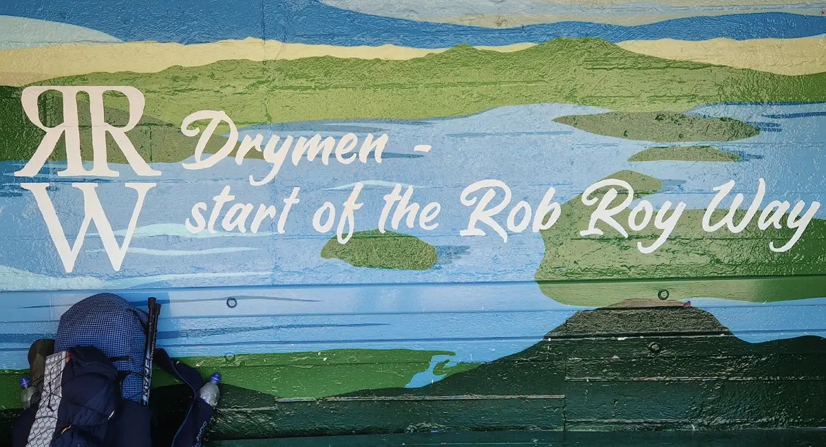
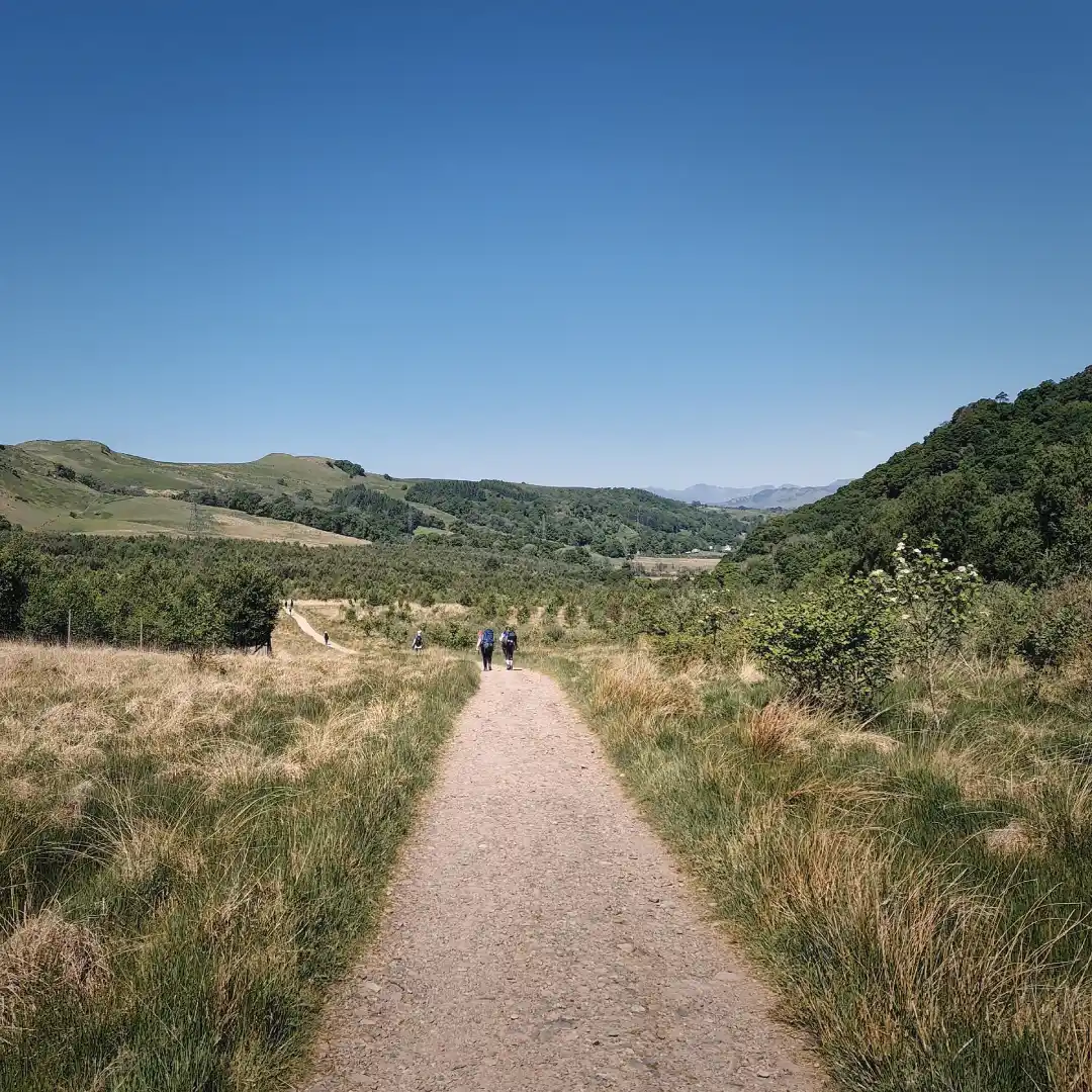
The official start of the RRW in Drymen.
Speaking of pubs, the RRW features quite a few – it certainly isn’t among Scotland’s most remote trails. In fact, in its basic form, the RRW snakes its way across the beating heart of the Trossachs from Drymen to Pitlochry, through various local settlements over a distance of about 127 km. I say basic because, as it happens, the trail can be adjusted to your liking. Shorter? No worries, give it the chop in one of the many towns or just nip in to fulfill your dire need for some deep-fried mars bars and a pint of Tennent’s. Longer? Well, why not add the first leg of the West Highland Way (WHW) and elbow your way from Milngavie to Drymen? More remote? Go full Bear Grylls and get lost in the wilder, more scenic variant from Ardtalnaig to Aberfeldy. Whatever the choice, the RRW certainly offers some top scenes and decent variability, catering to all sorts – perhaps even your nan. Now, I know what you’re thinking – if it’s so great, why does no one seem to walk it? Why is it quieter than my nan’s bingo hall on a Tuesday night?
Well, I’m of the opinion that the government authorities threw one final posthumous curse on Mr. MacGregor by placing his trail in the same boxing ring as the WHW, so to speak – and let’s be honest, the WHW throws quite the punch when it comes to scenery. In other words: a tough fixture and, rather unsurprisingly, most people lurking around the bottom end of Loch Lomond would put their money on the WHW rather than the RRW. But that’s alright, all the better even, because it leaves the RRW relatively untouched for those looking for a comparable, more tranquil Highlands experience. Think of a path away from the usual haunts, one that winds its way through some exposed moorlands, tangled forests and deep glens, one that hugs the shorelines of peaceful lochs and just about flirts with the edges of a couple rugged Munros. All this, yet never being far from civilisation and with little to no traffic. A tad grandiose perhaps, but I assure you, not far from the truth!
Just a couple of photos taken along the route. Acceptable views, if you ask me.
Itinerary
Okay, actions speak louder than words, so to prove my point as to why the RRW might just be worth tackling, I thought I’d whip up a short summary of my own experience – well, I say short, but what I actually mean is a PhD thesis. So bear with me, maybe in some parallel universe you might even pick up a couple ideas for your own route planning.
But before jumping into the drivel, I thought I’d give you the abstract here, which is to say that all of this dates back to May 2025, when I tackled an extended version of the RRW. Basically, I threw in both the first leg of the WHW and the alternative variant from Ardtalnaig to Aberfeldy, bringing the total distance to roughly 163 km. Although I personally wild-camped the whole route, it could just as easily be done by hopping from one B&B to the next. That I’ll leave to you – but to help with preparation, I’ve compiled a map of the entire route, complete with a bunch of information that might prove useful. Feel free to download the accompanying GPX file by simply clicking the hyperlink below the map!
Click HERE to download the accompanying GPX file!
Day 1 - 30km / +425m - Milgnavie to Kelty Water
Having spent the night in Glasgow, I was up and about super early to catch the train to Milngavie – a journey less than 25 minutes from the city’s Queen Street Station. Although the train was nearly empty, the short walk to the official starting point of the WHW quickly confirmed that Milngavie is, in fact, something of a spawning ground for adventurers from all over the galaxy. Not sure where they all parachuted in from, but I suppose it was to be expected, given that the WHW is perhaps the UK’s most popular long-distance trail.
Anyhow, the walk out of town was relatively easy-going, following a small river through a mostly wooded area before forking northwards past Craigallian Loch towards some more open scenery. After winding around a few exposed hills, the trail descended into a long marshy section where even the craftiest midge dodgers would surely have taken a hit. No wonder then that all insect repellent had practically flown off the shelves at one of the honesty boxes on this stretch. Fortunately, the little flying invaders had seemingly forgotten to conquer Gartness, after which the path eased down into Drymen and, in my case, as if by some enchantment, straight into the Drymen Inn, where a generous serving of fish and chips was devoured.
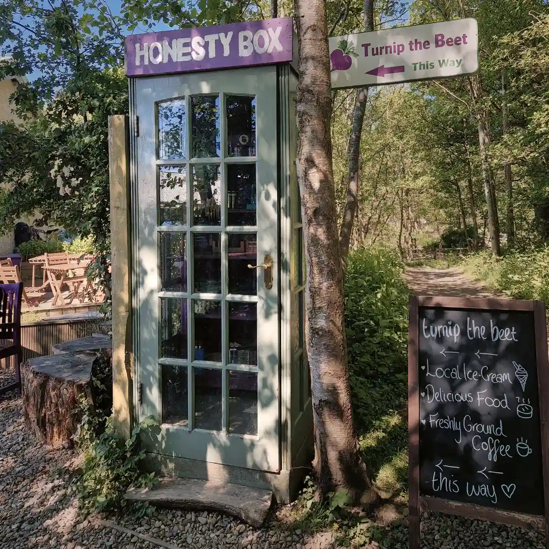
An early view from the trail and, of course, an honesty box.
After lunch and a quick re-supply at the local spar, it was time to abandon the WHW and to begin infiltrating Mr. MacGregor’s territory. Being in high spirits, I basically crowned myself king and decided to lead the charge out of Drymen, foolishly thinking that my army would follow. Little did I know that, as soon as the opportunity presented itself, all of my imaginary subordinates had slipped off westwards towards Conic Hill and the WHW, leaving me alone on the rather dull ascent out of town. Oh well, tail between my legs, I pressed on with the quest, reaching a small loch on some higher ground before dropping down to a crossroads of sorts. Here, I took a left onto a narrower cycling road, following it for what seemed like an eternity, until eventually stumbling into what felt like another country – and another time. Suddenly, emerging from the undergrowth, were some old Victorian structures, notably the Corrie Aqueduct, dating back to the mid-19th century and apparently still in good working order. Accompanying this relic were some old rusty ventilation shafts, just gently hinting at the presence of a shady underworld right beneath my feet. Being alone and with dusk slowly closing in, the atmosphere certainly grew slightly unnerving – not helped by the random rustles and crackles coming from the woods nearby. Long story short, I decided to leg it before being pulled into the abyss by Hades himself.
About two minutes later, judging that I’d put enough distance between me and Beelzebub, I came across a perfectly flat and cosy looking little clearing right by a small stream – a perfect spot to pitch my humble one man palace. As the weather was still reasonable, I took the opportunity to go for a cheeky little dip into the stream just to cool off before calling it a day.
A few highlights from later in the day.
Day 2 - 28km / +467m - Kelty Water to Loch Lubnaig
Refreshing morning, no need for a shower because apparently my tent had transformed itself into a right condensation station during the night – next time, I’ll know better than to pitch right by the water’s edge in a humid, windless area, especially when temperatures are expected to drop from daytime highs in the 20s to around 0°C overnight. Moreover, speaking of the night, I woke up around 3am to the most harrowing shriek imaginable, just a stone’s throw from my tent. I can only describe it as the sound of a woman in great distress, desperately screaming for her life – and although it lasted only a couple of seconds, it was enough to convince me that the Grim Reaper had parked for a picnic right outside my vestibule. Basically, I shat myself and fainted, eventually waking up inside my condensation trap and recalling that foxes are notorious for making such sounds. I sure hope it was a fox and that this wouldn’t turn into a recurring phenomenon – after all, I wasn’t lugging around a trolley full of Y-fronts.
So, not the best night’s kip, but at least the morning was nice and sunny. After packing up, the day began with an easy stretch through some dense woodlands, which continued for a good 7 or 8 km before reaching Aberfoyle – a quintessential little Scottish town with plenty of amenities. Here, I took the opportunity to nip into the local Co-op to replenish my diminishing stash of sausage rolls before heading to The Station Coffee Shop to nick some electricity under the guise of an early lunch (brilliant little café, by the way). With my batteries fully recharged, I then paraded down the town’s main street until eventually taking a sharp left turn and promptly disappearing back into the bush where I had come from.
Emerging from the woods just before Aberfoyle, followed by a view down the town’s main street.
The climb out of Aberfoyle was mild but seemingly never ending – though eventually, it levelled out into a stunning expanse of open grassland, overshadowed by a pair of high, imposing hills. After passing a small loch by the name of Hardy, the trail then descended towards the shores of Loch Venachar, which somehow turned out to be the biggest hive of activity on Planet Earth. I mean, there were people swimming, canoeing, picnicking, jogging, cycling, sunbathing… larping, honestly, name anything and it was probably being practised there. I thought I even caught a glimpse of David Attenborough and his crew, making the best of the situation, filming a special on the strange chronicles of the great human ape. But, truth be told, the whole thing gave me flashbacks of the WHW and so, after a short breather at the beach, I decided it was time to pad my elbows and charge right through the crowds.
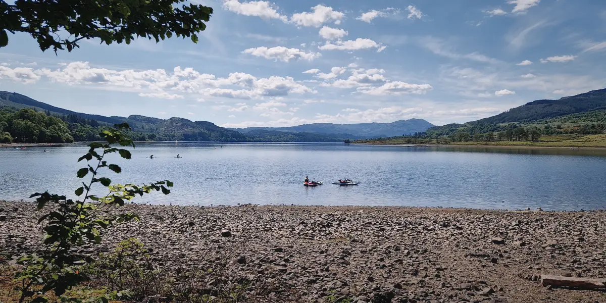
A westward glance across Loch Venachar.
After emerging victoriously on the other side, I decided to bypass Callander, since I had no need to stock up on any more sausage rolls. Following a short overlap with the Great Trossachs Path, I eventually joined a paved cycling road running parallel to the River Leny towards Loch Lubnaig. Aside from the Falls of Leny, which were most certainly worth seeing, this section left something to be desired. Not only did it run for kilometres on end through relatively dense vegetation with not much to see, but its narrowness meant that I was constantly having to cross-check cyclists off their bikes.
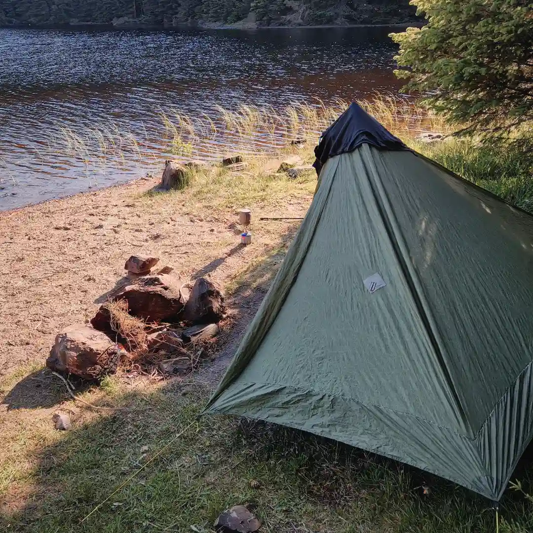
An hour or two of sustained damage later, I finally reached the mouth of Loch Lubnaig where I was able to pick up some plasters and other supplies at the Strathyre Forest Holidays shop. I then continued a little while further until eventually stumbling upon a splendid little sheltered spot not far from the water’s edge (but further than the day before, that’s for sure). Without delay, I bagged the spot, set up my tent, and promptly propelled myself straight into the loch for a quick bob. Afterwards, I had a bite to eat, did some shoreline gazing, and relaxed and reflected on the day before closing up shop for the night.
A few highlights from later in the day, and a rather dodgy pitch.
Day 3 - 22km / +456m - Loch Lubnaig to Lochan Lairig Cheile
What a peaceful night, slept like a toddler – no sign of condensation and, most importantly, no sign of Beelzebub. The morning began with a refreshing wee dip in the loch, followed by a bit of porridge and a good old brew. The sun was well and truly up by the time I got going, and what’s more, there wasn’t a single shred of cloud blocking the heavens.
The name of the game was to make the best of the elements and savour the day ahead. And what finer way to kick off the morning than a peaceful stroll along the shoreline of Loch Lubnaig? Honestly, there was something magical about letting the soft hum of the water and surrounding birdsong naturally define my rhythm – to the extent that I think I fell into some kind of meditative trance, almost as if bewitched by Mother Nature herself. The kilometres flew by effortlessly, and it was only once I reached Strathyre that the spell wore off, replaced by the steady intrusion of engines and the odd ‘hiya’ from passing locals. The contrast was rather stark, but it was nonetheless pleasant to see a bit of civilisation now and again.
Effortless kilometres along the shoreline of Loch Lubnaig, and the eventual arrival in Strathyre.
In Strathyre, I popped into the village shop for a coffee, then took a moment to sit down and admire the local car park and bin shed. After a little while, feeling sufficiently inspired, I set off back into the woods, where the terrain wasted no time reminding me who was in charge. The climb out of town was gnarly, to say the least, but thankfully the top gave way to a flat logging road, protected from the blistering sunlight by a canopy of tall trees. The path then continued steadily northwards for a good few kilometres, passing what looked like an abandoned quarry, before dropping straight down to the teeming terrace of the Mhor 84 Motel in Kingshouse. Here, after devouring a mouth-watering plate of fish and chips, I feel I managed to scare off half the clientele by exposing a truly horrid-looking builder’s bum while squatting to retrieve my charging powerbank from deep beneath the bench. Suffice to say, rising to a chorus of nothing but crickets felt very much like my cue to make a swift exit.
I wasted no time leaving Kingshouse and, in the same breath, decided it was better to skip the little diversion to Rob Roy’s grave in Balquhidder as well – after all, that would have added a whopping 6km to the route. Instead, I opted for yet another narrow cycling road running parallel to the A84 towards Lochearnhead. Not a whole lot to see on this stretch, but at least I successfully dodged the never-ending convoy of cyclists, arriving unscathed at a little bypass point just outside town. As I was in no mood to cause any further disturbances, I thought it wiser to stick to the cycle path and steer well and truly clear of Lochearnhead. This actually turned out to be a sound decision because shortly after a meandering little ascent, the path leveled out and gave way to some proper good views over Loch Earn. Even managed to bag myself a half decent spot for a short siesta.
A bit of everything, including one of the many RRW waymarks.
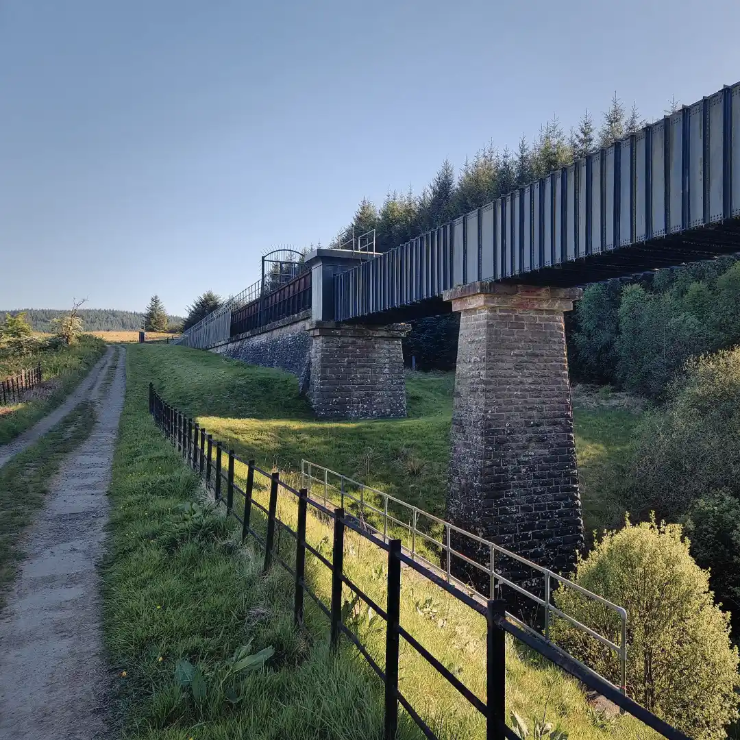
After waking up what felt like a couple of decades later, I decided it was about time to get going again. Soon after, I found myself following the path northwards into a wooded stretch, overlooked by some rather steep hills and the occasional cliff. The path then gradually gave way from hard tarmac to more forgiving gravel, continuing for quite some time before emerging out into the open. Suddenly, before me, as if on centre stage, stood the great Glen Ogle Viaduct in all its might and glory. And, standing on either side were two vast, barren hills, staring down with quiet judgement at the old structure intruding on their domain – no doubt a difficult crowd to win over. I marvelled at the scene for a good long while, until eventually snapping back into reality and realising that I may have slightly over-romanticised it. In the end, yes it’s an alright-looking Victorian era railway viaduct, carrying history and certainly worth mentioning, but perhaps somewhat belittled by the hills surrounding it. Under gloomier conditions, I’m sure it would make for a good photographic subject though.
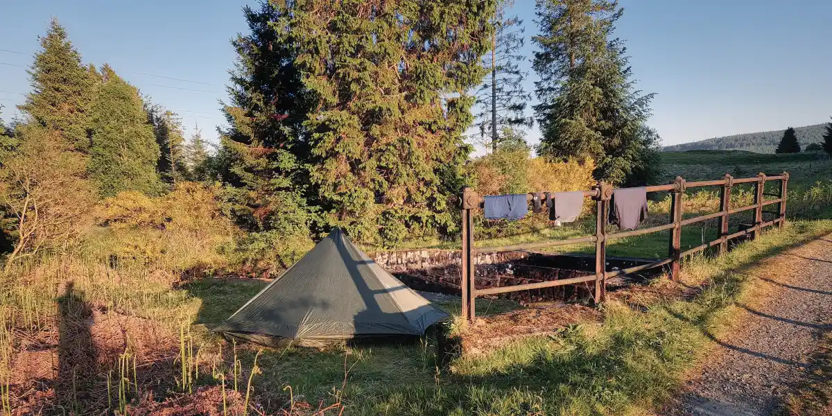
Just a few kilometres after the Glen Ogle Viaduct, I came across a small lochan by the name of Lairig Cheile. A decent spot with a few options for pitching a tent, albeit a touch too close to the busy A85 road. As there had been no decent wild camping spots up to this point, and having read it would be much the same all the way to Killin, I decided it would best to spend the night here. So, without further ado, up went my polyester palace, after which I followed protocol and chucked myself straight into the lochan for a cool-down and wash. Then, a bit of scran later, it was time to whip out the brick and knock my shattered self out for the night.
The Glen Ogle Viaduct and my camping spot for the night.
Day 4 - 29km / +830m - Lochan Lairig Cheile to Gleann a' Chilleine
Decent night’s kip, all things considered, despite the road swarming with campervan maniacs until an ungodly hour. Also, I’m fairly certain that David Guetta must have been parked nearby because at one point his music was basically blaring right into my ears. Either that, or it was one damn fine stereo – thankfully though, either he or the stereo must have realised it was the wrong venue, because after about 15 minutes or so it all died down.
I packed up quickly, as my goal was to arrive in Killin early enough to down a full Scottish breakfast (or two). With this in mind, I began the march with a wee hop over the A85 to join a cycle path leading northwards into a fairly dense wooded area – no chance of camping here, so spending the night at the lochan had certainly been a good shout. I continued along the cycle path for a good few kilometres, savouring the fresh air and tranquillity of the forest, while listening to a myriad of feathered friends freestyling a cocktail of morning tunes – pure bliss, to say the least. Eventually, without even realising it, I had arrived in Killin, where my moment of bliss was cut short by a great roaring sound that grew stronger with every step forward. I was half expecting William Wallace to be in town, but it turned out to be the Falls of Dochart having some kind of a row with Loch Tay. I guess things had taken a dramatic turn, because the force with which the former was driving water down the throat of the latter could only be described as carnage. A couple of photos later, I decided I could no longer tolerate the slaughter and had to do something about it. So, I followed what I know best: my nose – and fled the scene.
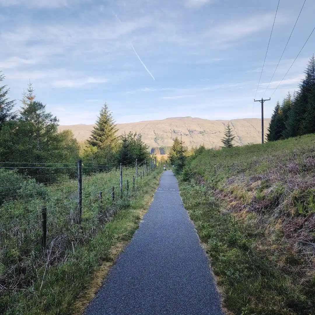
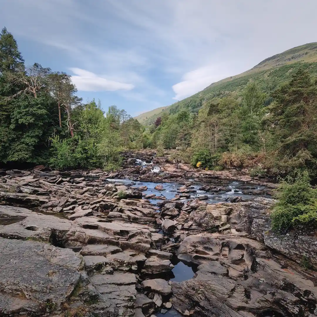
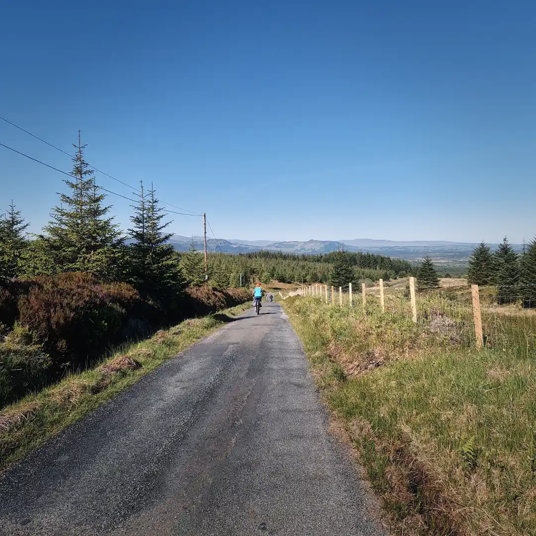
One of the many cycleways, and a first glimpse of the Falls of Dochart.
As I stepped off the bridge, I knew I had caught a whiff of something. Stirred by the thought and recalling my training as a sniffer dog, I quickly dropped to all fours to follow it more closely. And so, with great determination, I swept my muzzle blindly along the pavement until finally arriving at the source – a cosy local inn with its kitchen in full swing… or so I thought. Instead, it turned out I’d unwittingly followed the scent of a very different kind of haggis and ended up at the nearby public toilets for an unplanned pit stop. Not exactly what I had in mind, but convenient nonetheless. With business duly sorted, I then gave the muzzle another go, this time successfully navigating down the town’s Main Street and arriving at a cracking little café by the name of Shutters. With great urgency, I ordered my long-awaited full Scottish breakfast and quite literally proceeded to demolish it right there on the spot. With that task done and dusted, I then dashed out the door towards the local Co-op to restock on some much-needed supplies before swiftly fading back into the hinterland whence I had come.
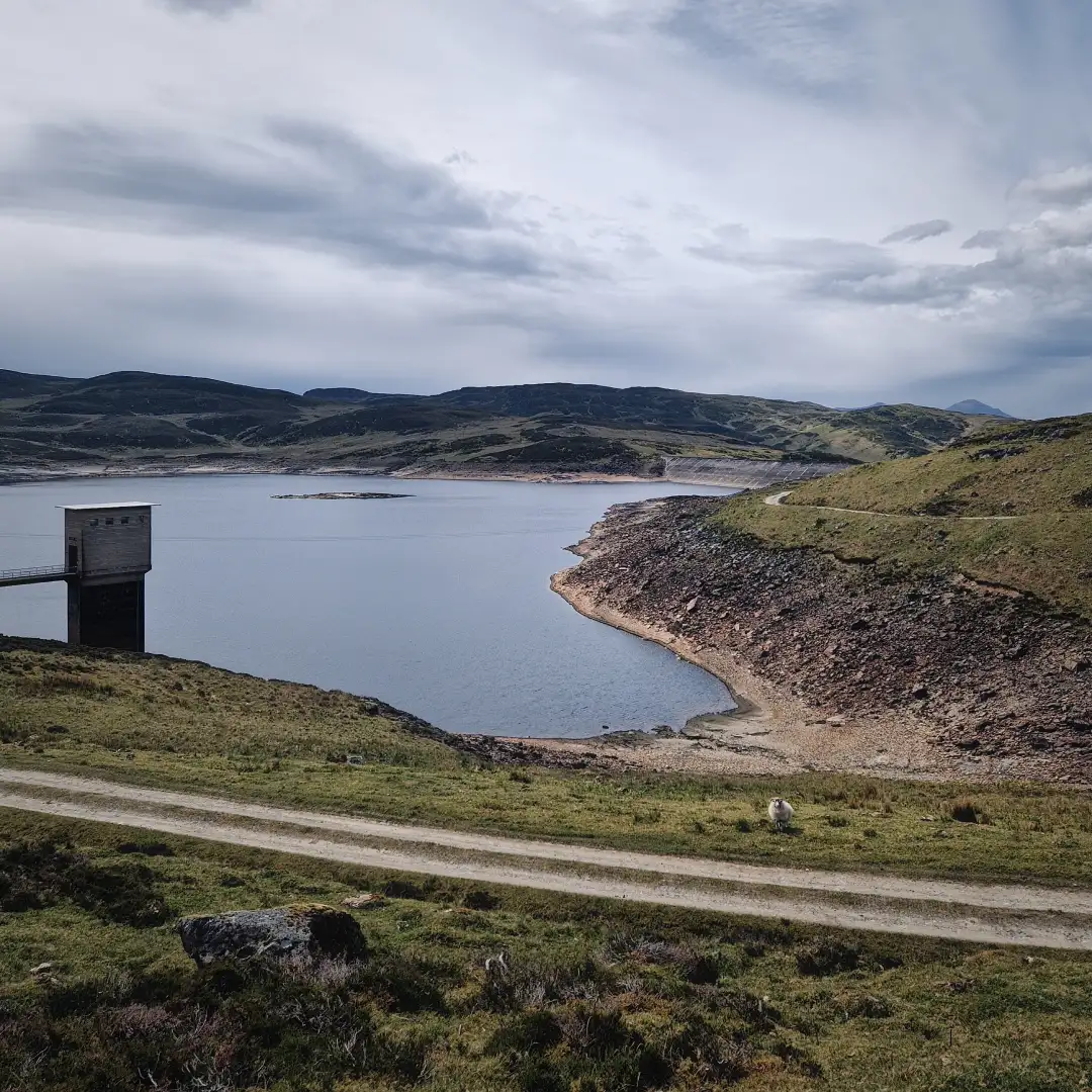
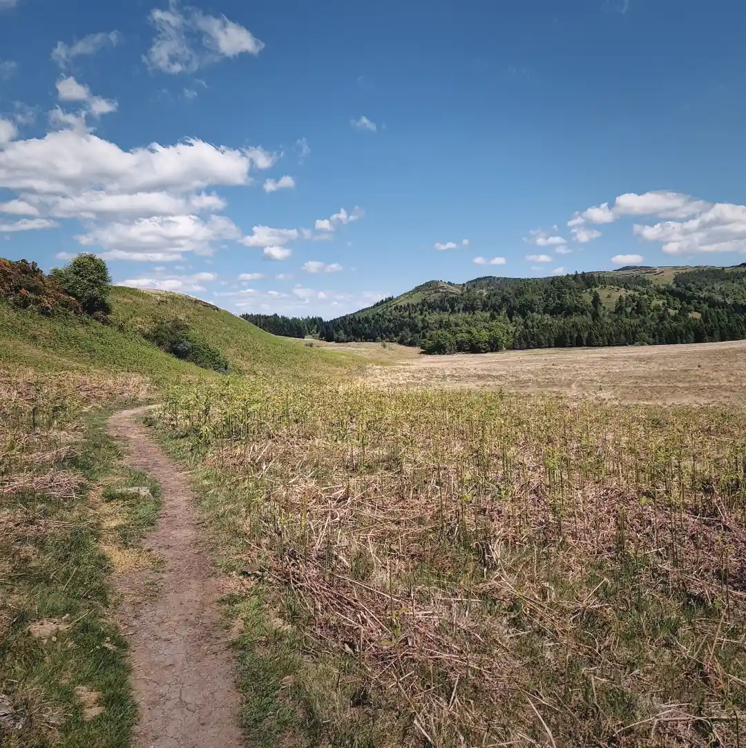
The climb out of Killin was killing – a right minger, to be honest. But it was worth it, as the path eventually levelled out into some absolutely stunning moorland, where, aside from a couple of sheep, there wasn’t a single soul in sight. I truly felt as though I had suddenly landed solo on a barren, forgotten planet, just waiting to be explored. Yet I must admit that the overcast skies and rugged terrain lent the place a slightly hostile feel. So I trotted forward cautiously, step by step, until I found myself skirting around the Breaclaich Water Reservoir and its rather apocalyptic-looking intake tower – an eerie but remarkable sight, especially for the occasional trespasser like myself. Deciding it best not to disturb the water and awaken whatever might lie beneath, I pressed on, serpentining my way across the striking landscape. And before long, I found myself following some overground water pipes, dodging a seemingly never-ending trail of sheep shite, and not realising I’d missed a sneaky left turn towards Ardeonaig. I basically had no choice but to double back through the sheep droppings, making sure I hadn’t missed a single one, until at last I managed to get my bearings back.
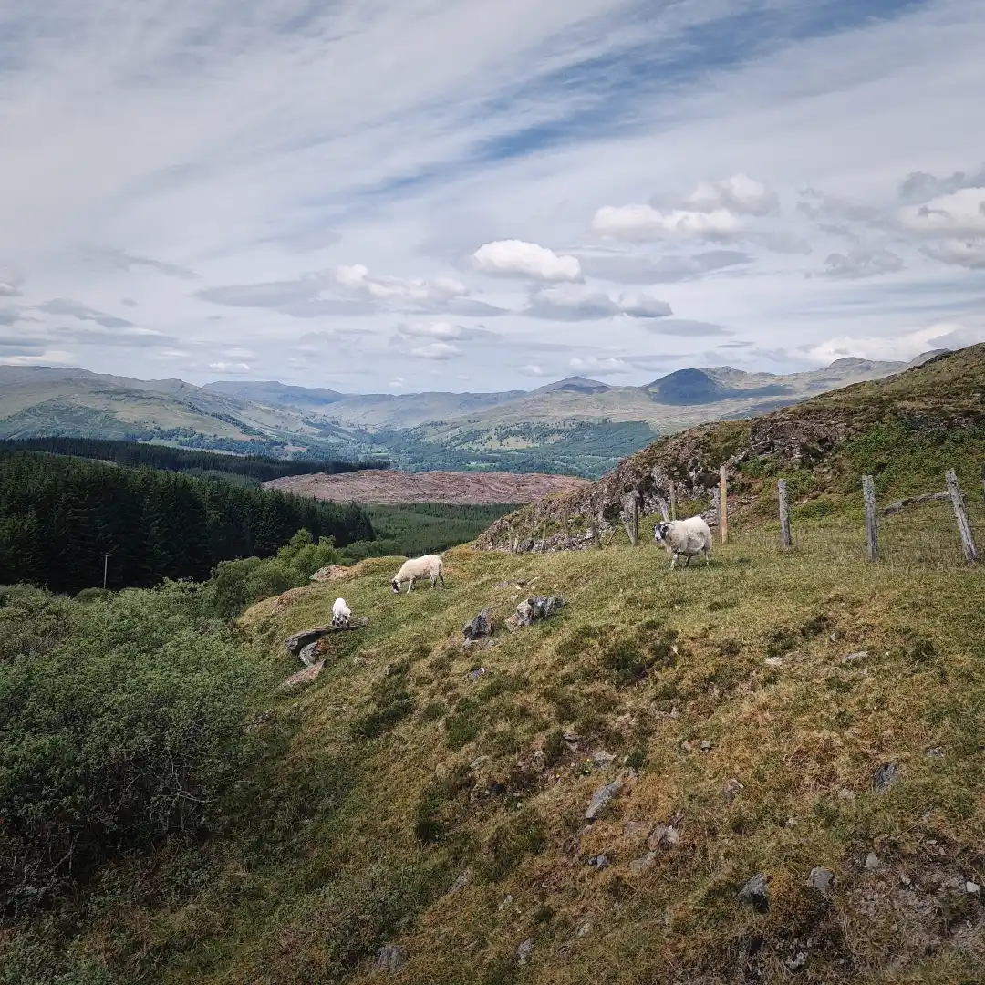
Sheep were plentiful, even in the remote moorlands between Killin and Ardeonaig.
The descent to Ardeonaig was long and gentle. Green pastures gradually replaced the rough, rocky terrain, and the sheep slowly gave way to cattle. A couple of moos later, I joined a road running parallel to the shoreline of Loch Tay, where every so often I was forced into the roadside ditch by passing lunatics in their Range Rovers. This went on for many a moon, but eventually I made it to Ardtalnaig, where I enjoyed a fruitful chat about the weather with an on-duty police officer, only for it to dawn on me that the ‘officer’ was in fact a cardboard cutout, presumably there to discourage speeding motorists – not so effective, it seems. Anyhow, hoping nobody had witnessed this exchange, I cracked on on until stumbling upon a classic red telephone box by the roadside, guarded by a pesky little hound that promptly came charging at me. In a desperate attempt to startle this bloodthirsty Chihuahua, I made an abrupt right turn and sprinted eastwards, away from the official RRW and towards Gleann a’ Chilleine. It was a successful stunt, but with Loch Tay now slowly fading into the distance, I found myself committed to the alternative route to Aberfeldy, with no chance of turning back.
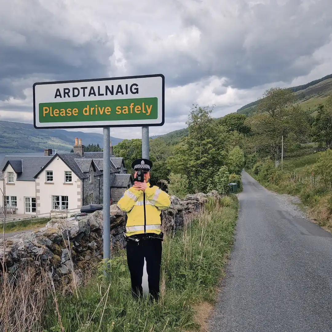
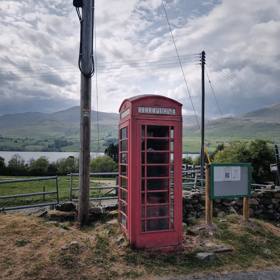
A determined copper and a classic red telephone box.
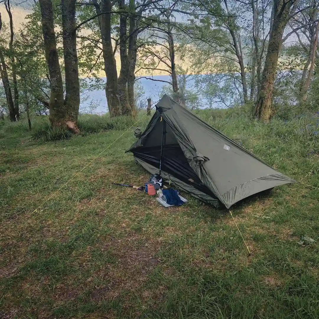
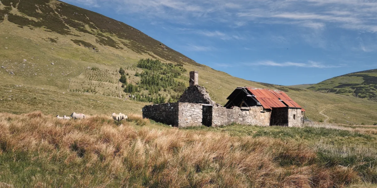
The day had already been very long, so after leaving Ardtalnaig, I was in quite the haste to find a wild camping spot. In fact, I had a place in mind, by an old wall just after the last farmhouses – but to my dismay, someone apparently had the same idea and had already claimed the spot. Rather than launching a full-on assault, I did the reasonable thing and toddled on a bit further until coming across some rocky ruins, presumably a very old sheep pen. As the wind was picking up, I quickly set up my tent behind the remnants of a battered wall – then proceeded to prepare a high-quality culinary experience of dehydrated tikka masala and lukewarm water. With that out of the way, it was then time to gracefully surrender to the hay.
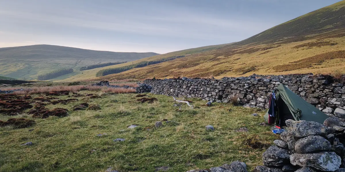
A decent sheltered spot to spend the night.
Day 5 - 33km / +585m - Gleann a' Chilleine to Green Bothy
The night was windy and cold, but fortunately the ruins provided the tent with a fair degree of shelter from the worst of the gusts – goes to show the value of choosing a decent camping spot, I guess. By contrast, the morning was an absolute delight, with the sun timidly revealing itself through a thin veil of mist that had settled upon the glen. Through the mist, I could just about make out the glimmering silhouettes of distant hills, forming an almost picture-perfect frame for the few sheep grazing quietly in the foreground. Without exaggeration, I could have stayed there forever, but as the saying goes, ‘make hay while the sun shines’, so that’s what I decided to do.
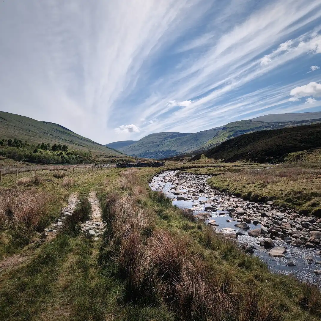
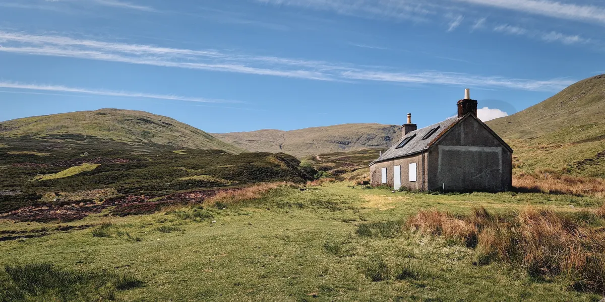
After baling up my belongings, I packed away the rake and embarked on the trail, knowing that the day ahead would be long and sweaty. And sure enough, in just a matter of seconds, the blazing sun had done its duty and juiced me dry, leaving behind nothing but a little raisin of a man. But that’s alright, because all it took was a faint breath of wind to propel me forward into the very bosom of the Great Glen, where I drifted quietly through the hummocky landscape, listening to the soothing hum of a nearby stream, until I eventually reached the remains of a forsaken settlement by the name of Dunan – a rather Elvish name, if you ask me. Hoping there were no Orcs knocking about, I sat down for a short breather against the walls of an adjacent hunter’s cottage, taking a moment to marvel at the stunning scenery, before plucking up the courage to venture further on.
Some stunning views further into the glen.
The sun was now mercilessly reigning over its earthly kingdom and only as I dialled in my bearings eastward down the River Almond did I become aware of its brutal hellfire chasing my every step. Yes, the next few kilometres, albeit breathtaking, with the surrounding hills slowly closing in around the glen, were truly laboursome – to the extent that I found myself growing strangely envious of the few salmon swimming about nonchalantly in the Avon. And just as the sun had almost finished transforming me from the raisin that I was into the scaliest of fish, I reached Auchnafree, where the trail branched away from the river’s main artery towards Loch Freuchie and Amulree. Here, after passing a few farmhouses, I arrived at a gate whose lock turned out to be more difficult to operate than Han Solo’s Millennium Falcon. Fearing imminent defeat and the shameful 100-kilometre walk back to Milngavie, I desperately fiddled with this monstrosity of a lock, employing every trick in the book, even casting a few spells – but to no avail. And so, with tears in my eyes, I decided to try the last trick up my sleeve and jump the fence. To my amazement it worked and, my days, was it worth it because soon after I found some sorely needed shade beneath the canopy of a patch of pine trees.
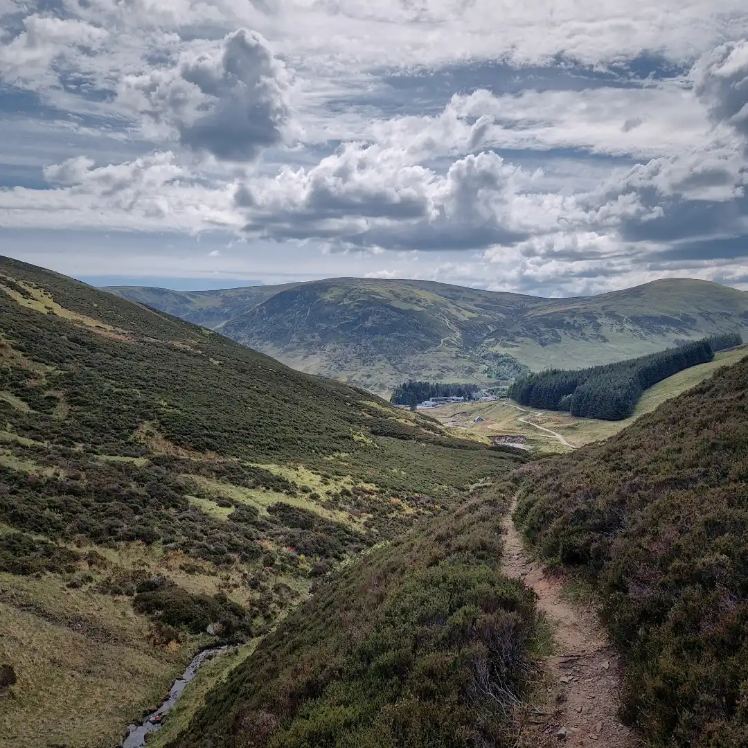
Unfortunately, the respite was all too brief, and I soon found myself back out in no man’s land again. Hounded by that big yellow thing in the sky, I eventually arrived at a small footbridge over the Glenshervie Burn, a good spot to restock water supplies, considering that it would pretty much be the last option until much further into the day. Afterwards, I unwittingly took a wrong turn, climbing westward for a good kilometre or so before consulting my offline map and realising I was on course to end up in Greenland in a few weeks’ time. Turns out that just after the footbridge, I should have headed north-east into a much narrower, somewhat overgrown, and still more remote-feeling glen – a bifurcation which remained anything but obvious, even after backtracking and performing a thorough Sherlock Holmes-style forensic examination. Oh well, at least I found my way, and thankfully so, because this hidden little glen was truly one of a kind. Not only was the path through it narrow and wild, but it also ran along the slope of the ravine, providing some sweeping views over the surrounding lands.
A battered farmhouse and a more than decent path away from the River Almond.
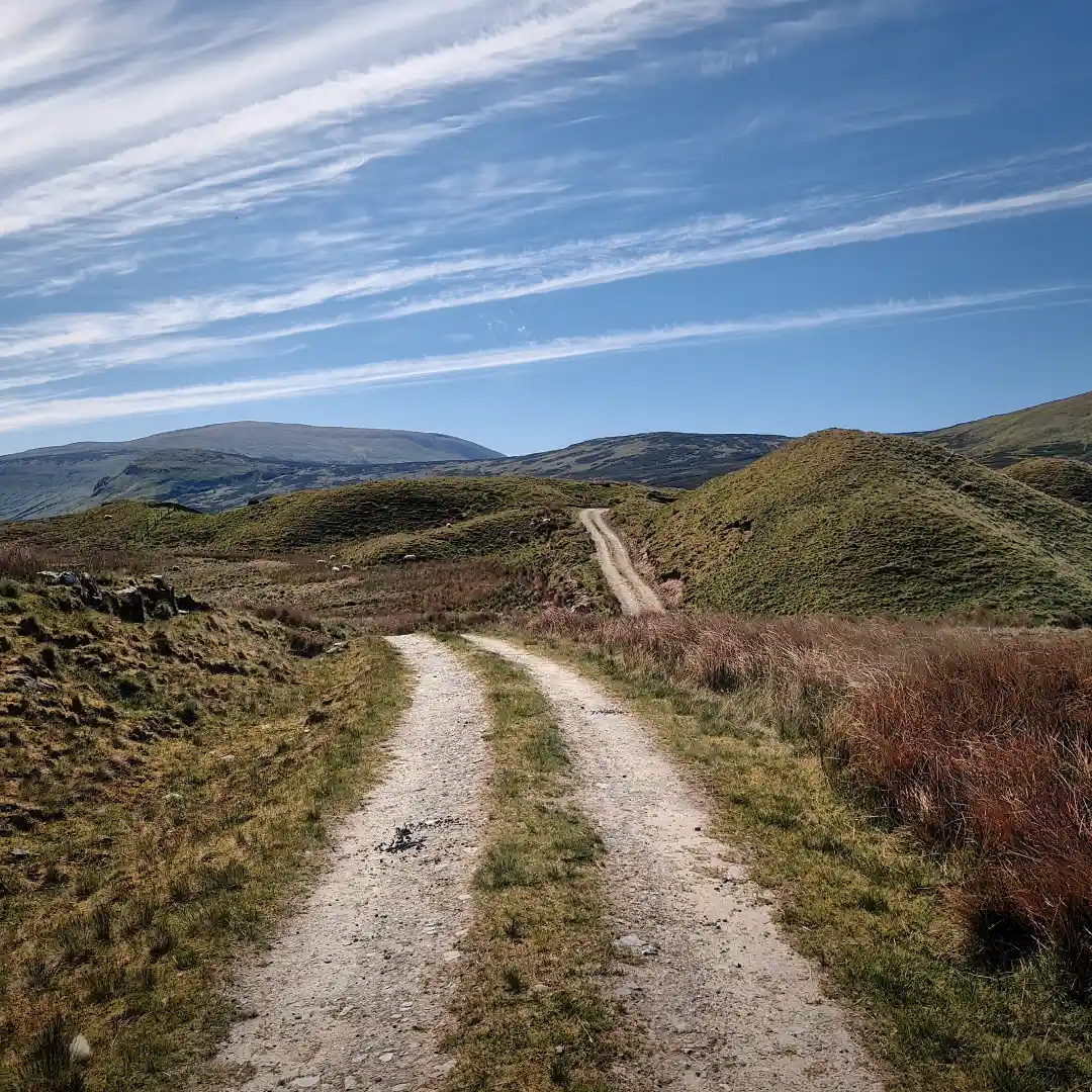
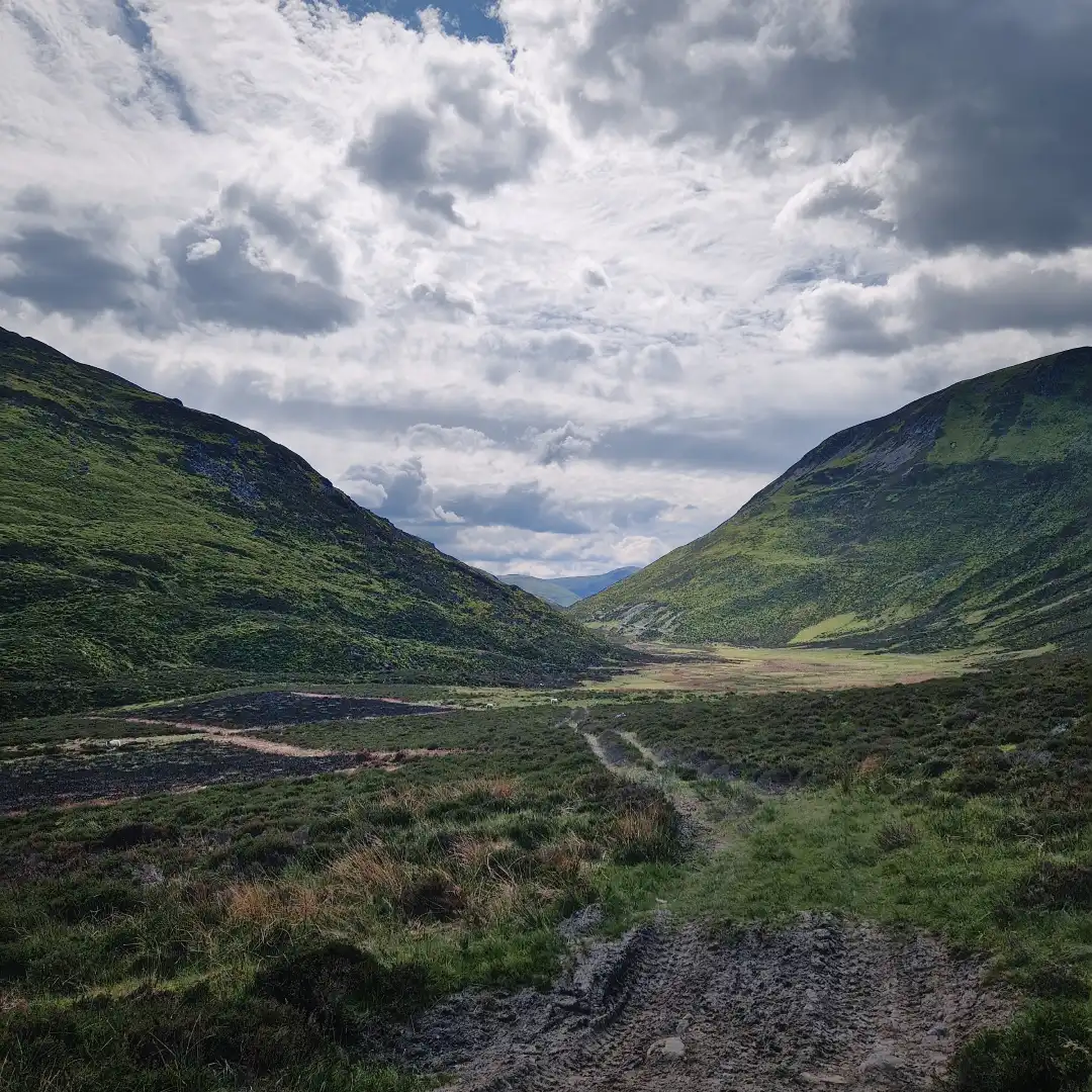
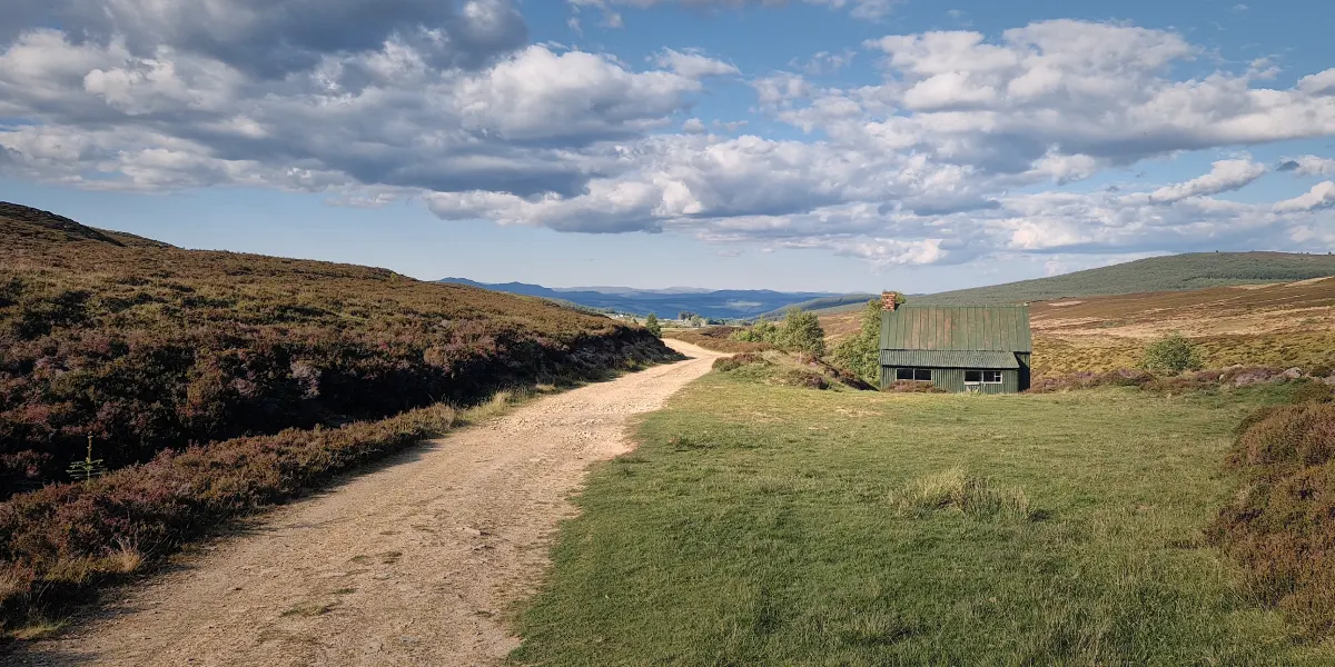
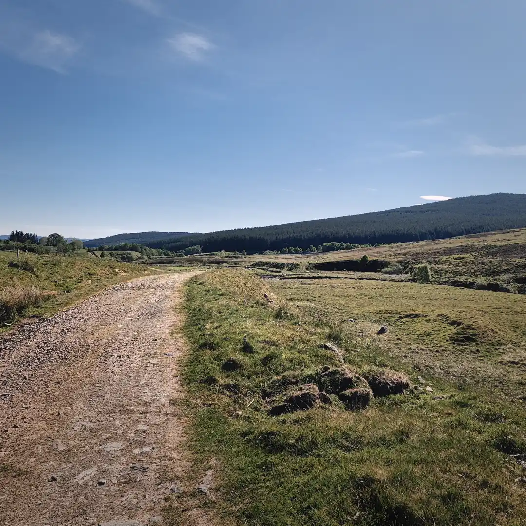
After downloading and processing as much of the stunning landscape as I could, it was time to zip the file, stash it somewhere in the back of my so-called brain, and move on. And so, before I knew it, I found myself descending towards a barren open plain, one that would certainly have made for the greatest bog-fest of our time, had the conditions been more dire. Luckily not this time though, meaning that I was able to whizz over the terrain at light speed, reaching a shady little lochan at the foot of an even shadier-looking hill. Not sure if I mentioned how shady it got, but I was convinced I had suddenly strayed into the domain of some kind of Highland troll, especially given the handful of old animal bones scattered about here and there – assuming, of course, they actually were animal bones. Suffice to say, feeling that I was being watched, I didn’t waste any time hanging around and instead kept trotting on until I reached some good old familiar farmlands. From here, the path eventually joined a paved road, where a decision had to be made: turn right towards Amulree and make a slow 180-degree drift around Loch Freuchie, or turn left, forget all that nonsense, and save the trail runners about 8 kilometres of wear and tear. I chose the latter, as the day had already been long and there didn’t appear to be much worth seeing in Amulree anyway.
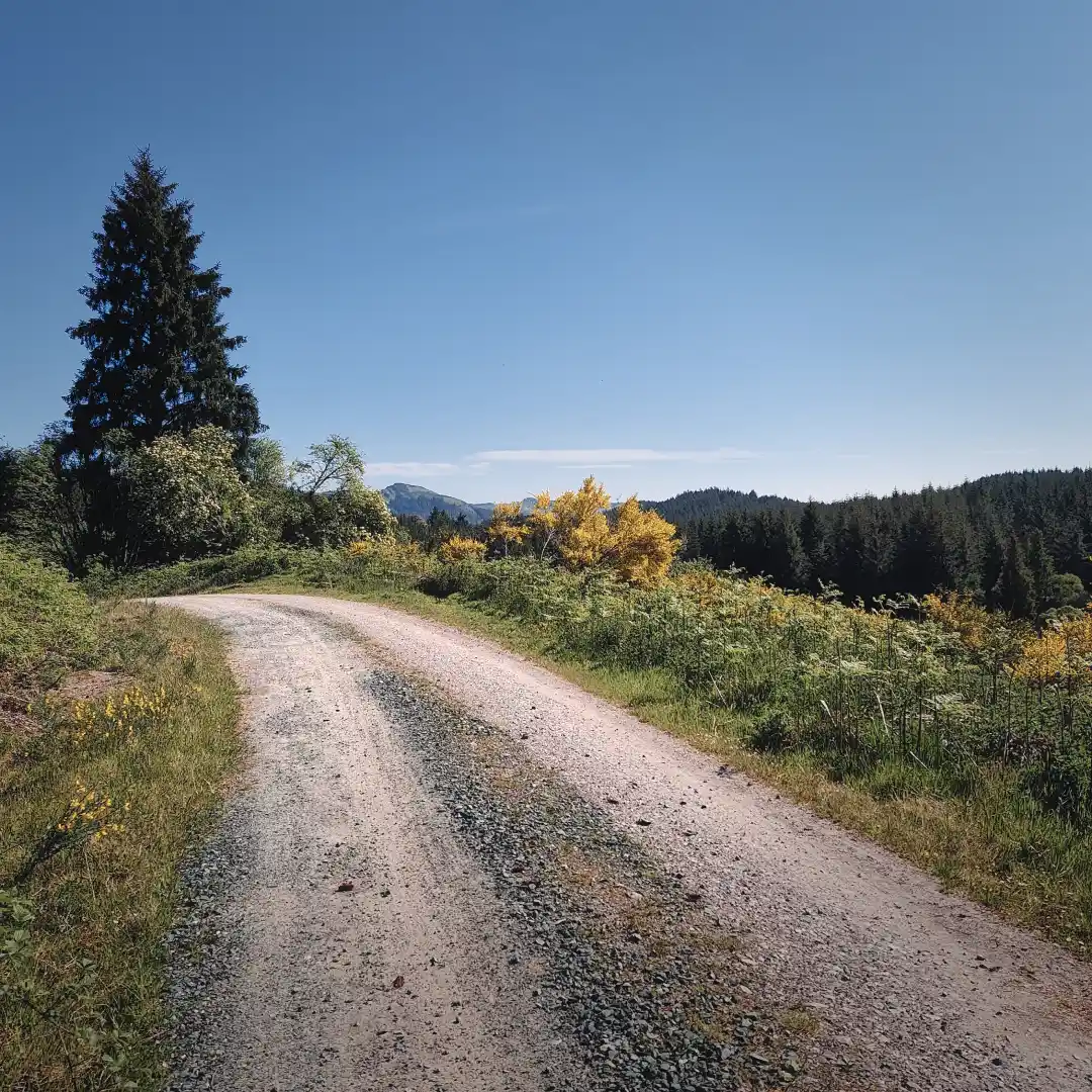
The next stretch certainly tipped the scales back towards the unremarkable side of things. Indeed, road walking was followed by road walking, with the occasional section through sheep pastures marked by the return of the dreaded midge. Despite passing through a fairly built-up area, I was surprised to see that there were no cafés, shops, bingo halls, or any services for that matter – I guess people around here are self-sufficient, or must travel quite far to collect their loot. Anyhow, I eventually reached Garrow, from where the path (by which I of course mean a paved road) branched relentlessly up into the hills overlooking Glen Quaich. The views were quite spectacular, but by the time the path levelled out I was absolutely drenched in blood, sweat, and tears. Out of water and motivation, I then continued on for a short while, after which, by a small pond, the trail forked away from the road and into the surrounding moorland. From there, it was another four kilometres until I finally reached a bothy, just by the side of the trail, unoccupied and practically calling my name… what a relief!
I wasted no time settling into the bothy, claiming a spot right by the door on two benches I’d pushed together to give myself a decent bit of elevation off the ground – after all, who knows what sort of creatures roam the bothy floor during the night? Afterwards, I slid arse-first down to the nearby stream to filter some water and wash away the day’s stink. Then, as per protocol, it was time for some scran before force booting the brain and body into recovery mode for what hopefully would be a peaceful and uninterrupted night.
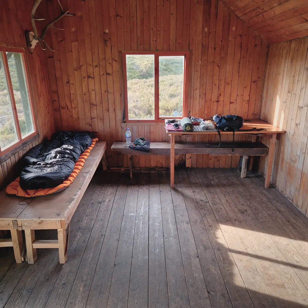
What a relief it was to arrive at the bothy later in the day.
Day 6 - 21km / +376m - Green Bothy to Pitlochry
The night was otherwise alright, though I did wake a few times to what sounded suspiciously like the bothy door being prised open. But that, of course, was just my rampant mind betraying me, as per usual – after all, I had dug extensive fortifications around the bothy, complete with state-of-the-art artillery systems, laid down multiple rows of land mines, and even gone so far as to put a broomstick against the door to alert me if any unwelcome spirits came busting through. So, in hindsight, I’d say I was adequately prepared, but nevertheless, the experience remained slightly unnerving – and I certainly didn’t make it easy for myself to leave that morning, having to dodge all the lethal weaponry lying around.
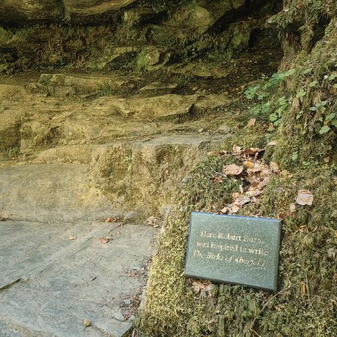
Speaking of the morning, today was the final day on the trail! And with it, the inevitable return to civilisation. So, after the usual morning chores, I put on my best suit and waxed my moustache, then quickly glanced at my golden pocket watch before donning the top hat and heading straight out the front door towards the rising sun. The day’s first task was a leisurely stroll down the remaining moorland, past a few lone farmhouses and onwards into the renowned Birks of Aberfeldy. Almost immediately after entering the foliage, I was confronted by the majestic Falls of Moness, a cascading series of waterfalls feeding fresh life into the River Tay through a meandering little burn. Equally meandering was the trail that followed, slowly descending through an almost dreamlike woodland towards the town of Aberfeldy – I could easily see why Robert Burns, the national poet of Scotland, would have come here in search of literary inspiration. And apparently I was not the only one to think so, because soon after I bumped into some fellow RRW hikers for the first (and last) time – namely two elderly gentlemen from Edinburgh, seemingly engaged in debate over the relative merits of Mr. Burns’s works. I believe they were on their fifth and final day on the trail, having taken the standard route through Kenmore and stayed in B&Bs, which goes to show that the trail can also be completed without having to lug around land mines and the rest of it. Anyways, judging that I had nought to contribute to their discussion, and having apparently forgotten all my social skills at the bothy, I wished them goodnight and continued on with my morning.
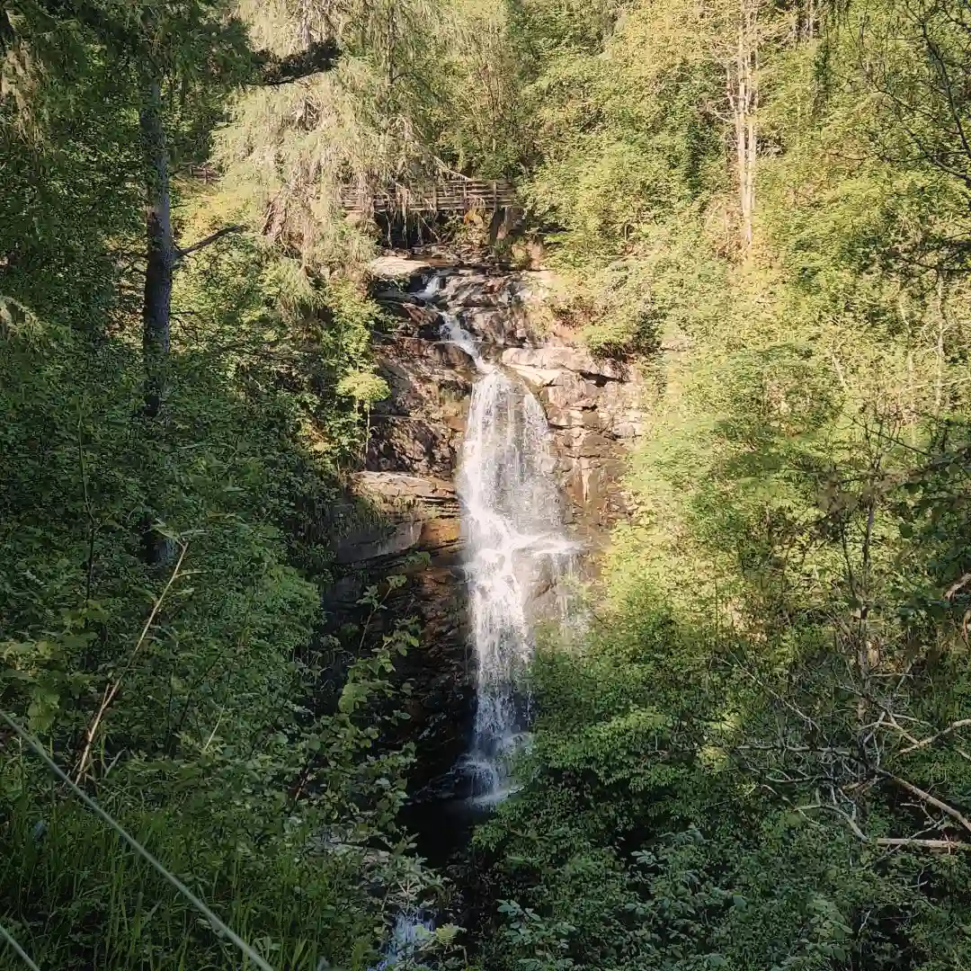
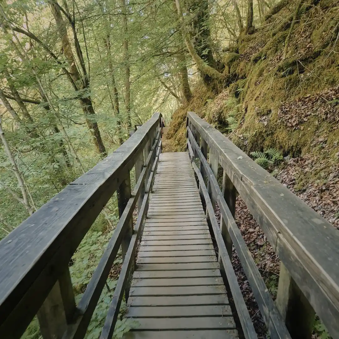
The Falls of Moness and a few other notable sights from that morning.
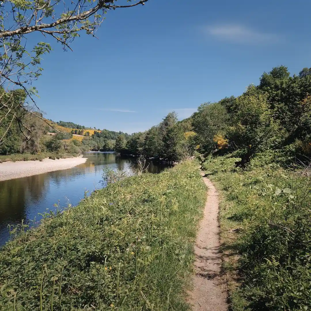
In Aberfeldy, I made a quick pit stop at the local Co-op to grab a gigantic Costa coffee and some good old Highland sushi, both of which were annihilated right there on the spot. Feeling a bit jittery, I then skipped down the road towards the town’s distillery, from where the trail, like a drunkard, swayed off towards the banks of the River Tay – though thankfully not quite into the river itself. The next few kilometres followed the way of the water, proving to be fairly easygoing and flat, sometimes through open pastures, at other times through dense tree cover – nothing in the way of sweeping landscapes, but nice nonetheless. My only gripe was the return of the mighty midge, which seemed to thrive wherever the blistering sunlight failed to reach – but, I suppose this was to be expected given the proximity of the river and the somewhat humid microclimate. In any case, the little mingers didn’t get much of a feast, as whatever blood I had left had long since gone foul in the sunlight anyway.
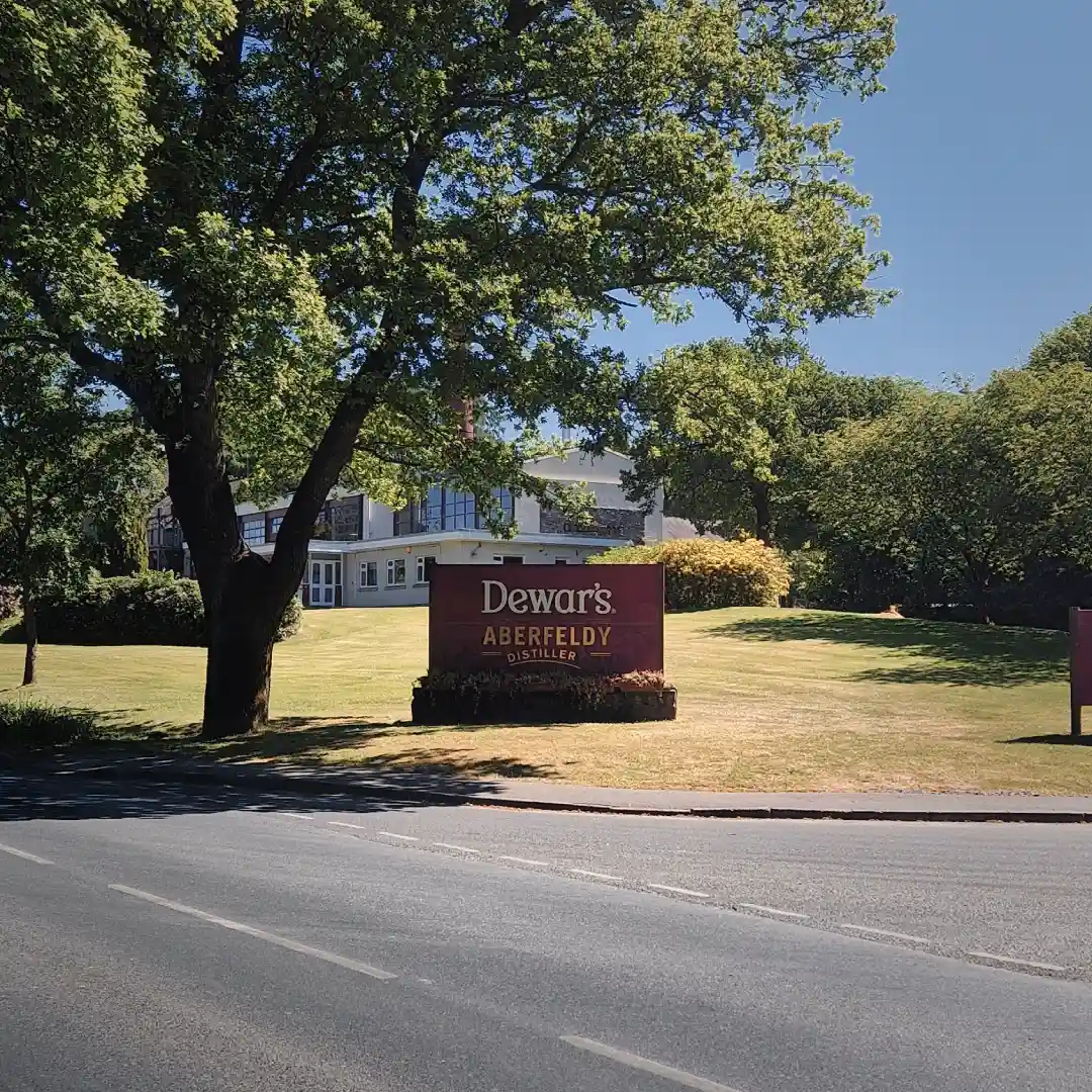
Some whisky before continuing along the River Tay.
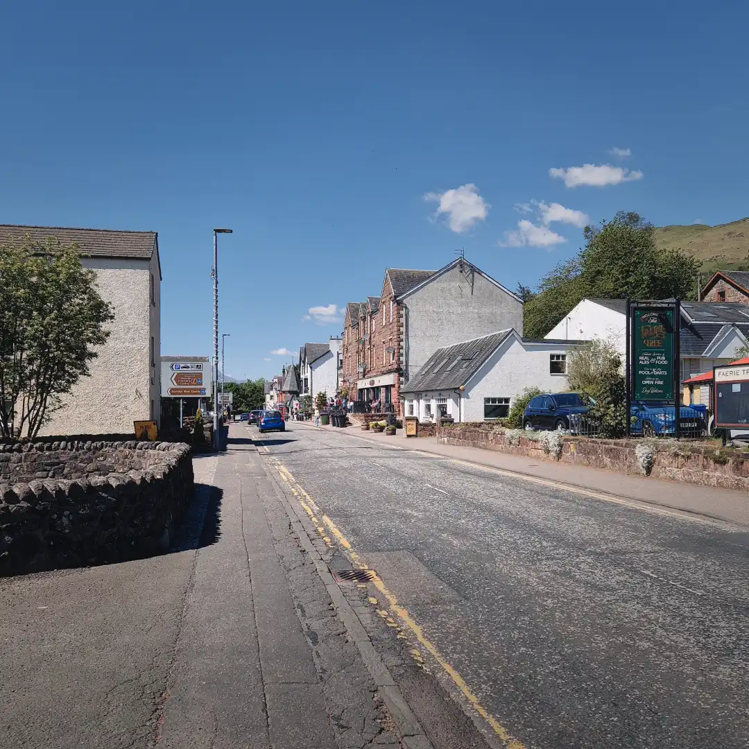
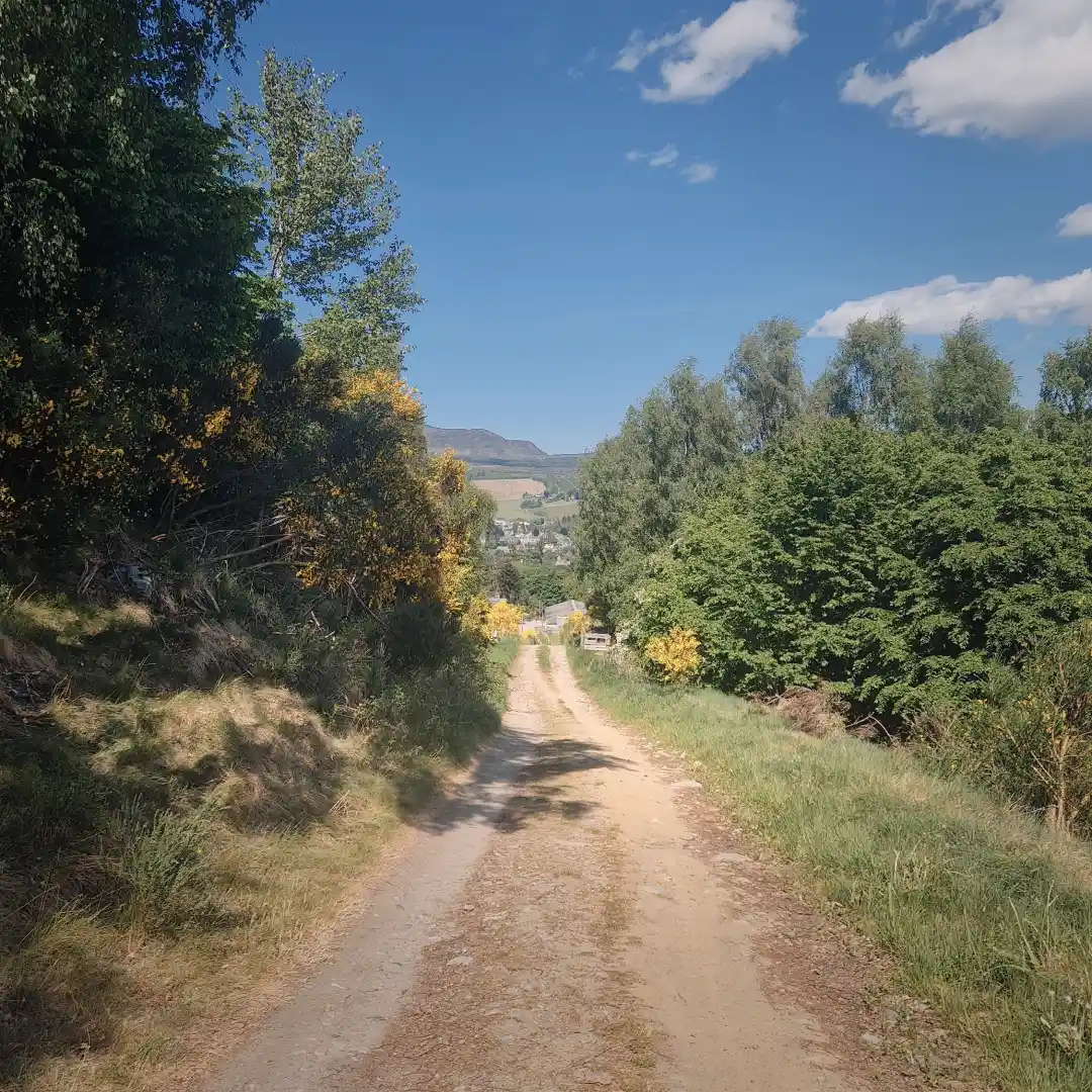
Eventually, I arrived in Grandtully, a cosy little settlement nestled between two bends of the river, with surprisingly much to offer. By this I mean there was a campsite, a couple of inns, a golf course, and even a chocolatier that would certainly have made Willy Wonka jealous. Deciding to spare the good people of the shop from my appetite, I continued on, across the bridge to the other side of the river and onwards towards the golf course. At some point, I must have taken a wrong turn, because soon after I found myself stumbling onto a fairway where the local golf legend was lining up a juicy eagle – at least according to himself. Thankfully, after bending a couple of irons around my neck, he had the decency to point me into the bushes, where I half-expected his mates to be waiting to finish me off. Luckily, not this time – instead, what followed was an arduous climb out of town into the surrounding hills, where I was rewarded with one final sweeping view over the stunning landscape. Afterwards, the trail faded into a dark and somewhat gloomy forest, where a long, knee-destroying descent towards the end line in Pitlochry began.
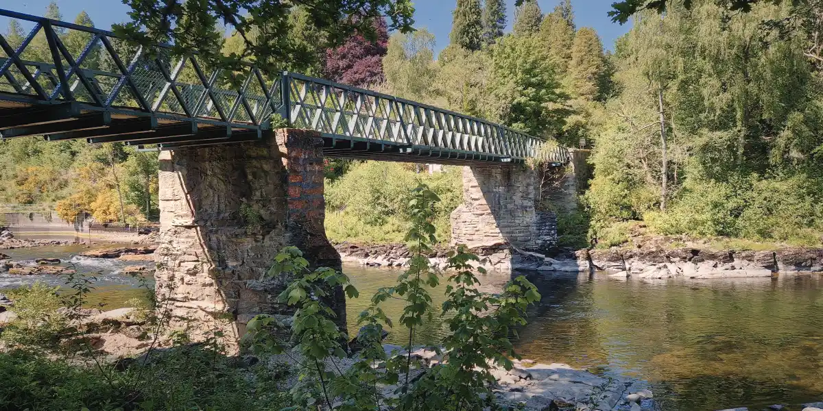
An impressive bridge over the River Tay.
Indeed, the descent into Pitlochry proved to be something of an ordeal, both physically and mentally. Writing off my kneecaps was certainly one thing, but the bigger challenge was maintaining my mental resilience during the final push. Don’t know about you, but my whole body always seems to shutoff right before completing an adventure, whether it’s a long-distance trek or just a simple hop over to the fridge. In any case, I pushed through and eventually rolled into town, where my expectations of a red-carpet welcome and a standing ovation were quickly shattered by a gang of tracksuit neds smoking what seemed to be the dankest cheese known to man. A rather precipitous return to reality, yes – but that’s alright, because for me it marked the end of another trail and, more importantly, another journey!
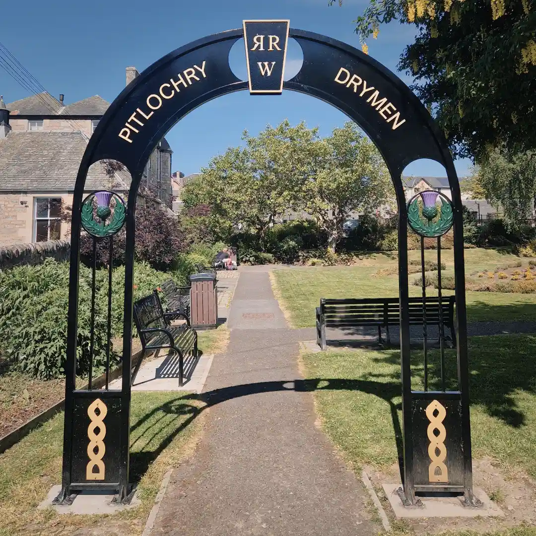
Final steps and the arrival in Pitlochry – pleased to see that there was an official ending point!
In a nutshell
All in all, the RRW is excellent and certainly worth giving a go. Yes, there is a fair bit of paved walking, and yes, the stretches between towns are somewhat longish. But honestly, these few drawbacks are far outweighed by the trail’s ease of access, customisability, and variety.
For me the best parts were, hands down, the stretch between Killin and Ardeonaig and the alternative route from Ardtalnaig to Aberfeldy. Both felt more remote and offered some absolutely exceptional views. While the alternative route is probably more suitable for wild camping, I believe it could also be done by hopping from one B&B to the next. At the time of writing, I saw there is a B&B in Corriemuckloch, not far from Amulree, in which case you could plan the route from Ardtalnaig to Corriemuckloch and then on to Aberfeldy. However, this would require knocking out two 27 km days back-to-back… so be sure you’re fit for purpose!
Finally, brethren, below is a very concise summary for anyone who wants to copy my exact itinerary. Peace out – and remember to leave no trace!
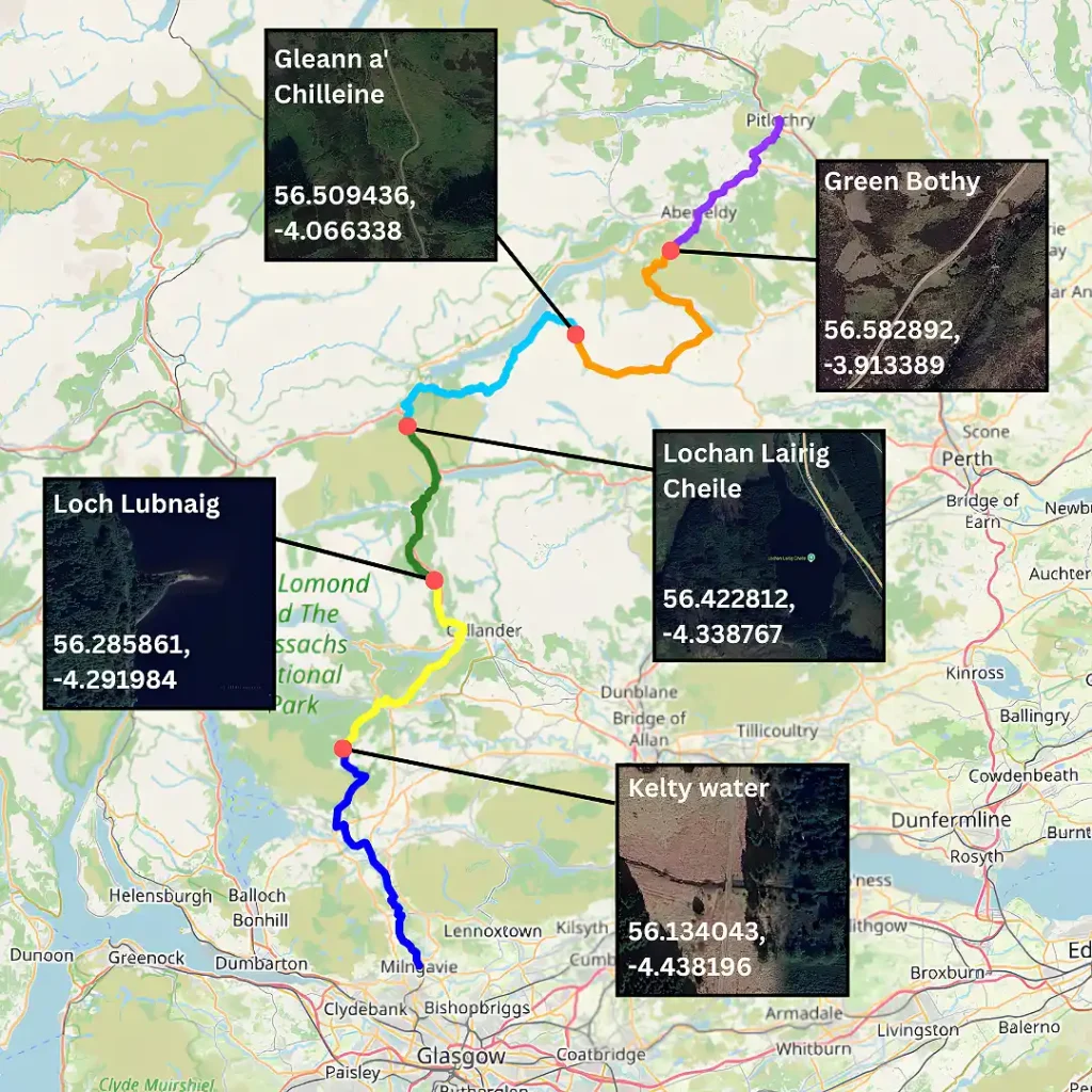
The journey in a nutshell, including the coordinates of each overnight stop.